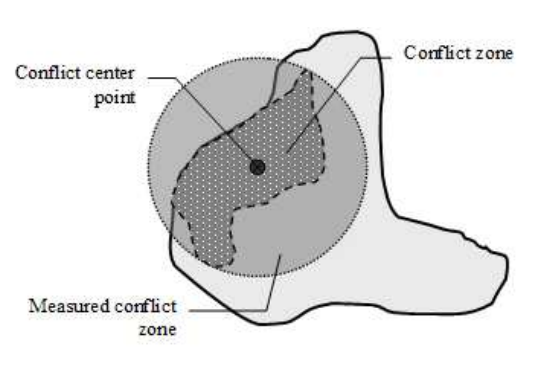
The Conflict Site Dataset is an extension to the UCDP/PRIO Armed Conflicts Dataset that provides coordinates for the conflict zones and lists of countries in which the conflicts were located. Following the procedure of earlier versions of the UCDP/PRIO data (up until v. 3-2005), the conflict zones are coded with center-point coordinates plus a radius variable to denote spatial extent. See codebook for further information.
For a longer time-span from 1946-2005, see version 2.