PRIO-GRID

The PRIO-GRID dataset is a spatio-temporal grid structure that contains socioeconomic and environmental information about all terrestrial areas of the world.

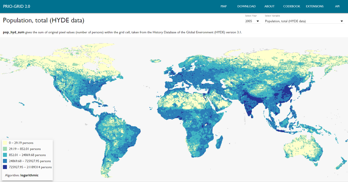
The PRIO-GRID dataset is a grid structure that aids the compilation, management and analysis of spatial data within a time-consistent framework. It consists of quadratic grid cells that jointly cover all terrestrial areas of the world.

Each grid cell contains cell-specific information on socio-economic conditions, ethnic groups, physical attributes, climatic conditions and more.

Technical Details

Current version: 2.0

Updated: 2 Jun 2016

Range: 1946 - 2014

Units: Cell, Year

Coverage: Global

Formats: CSV, Shapefile

An error has occurred. This application may no longer respond until reloaded. Reload 🗙